Conquering Swiss mountain passes: shuttle trains or highway detours?
Getting to the canton of Valais (or Wallis) by car is not obvious. Driving from the north to the iconic Zermatt or Saas-Fee, we will face the dilemma of whether to make up almost 150 km or load the car on the train. Is the shorter route faster? I check out the facts and myths of transporting a car by rail tunnels in Switzerland. As befits a site about winter sports, in this article I will focus exclusively on winter travel.

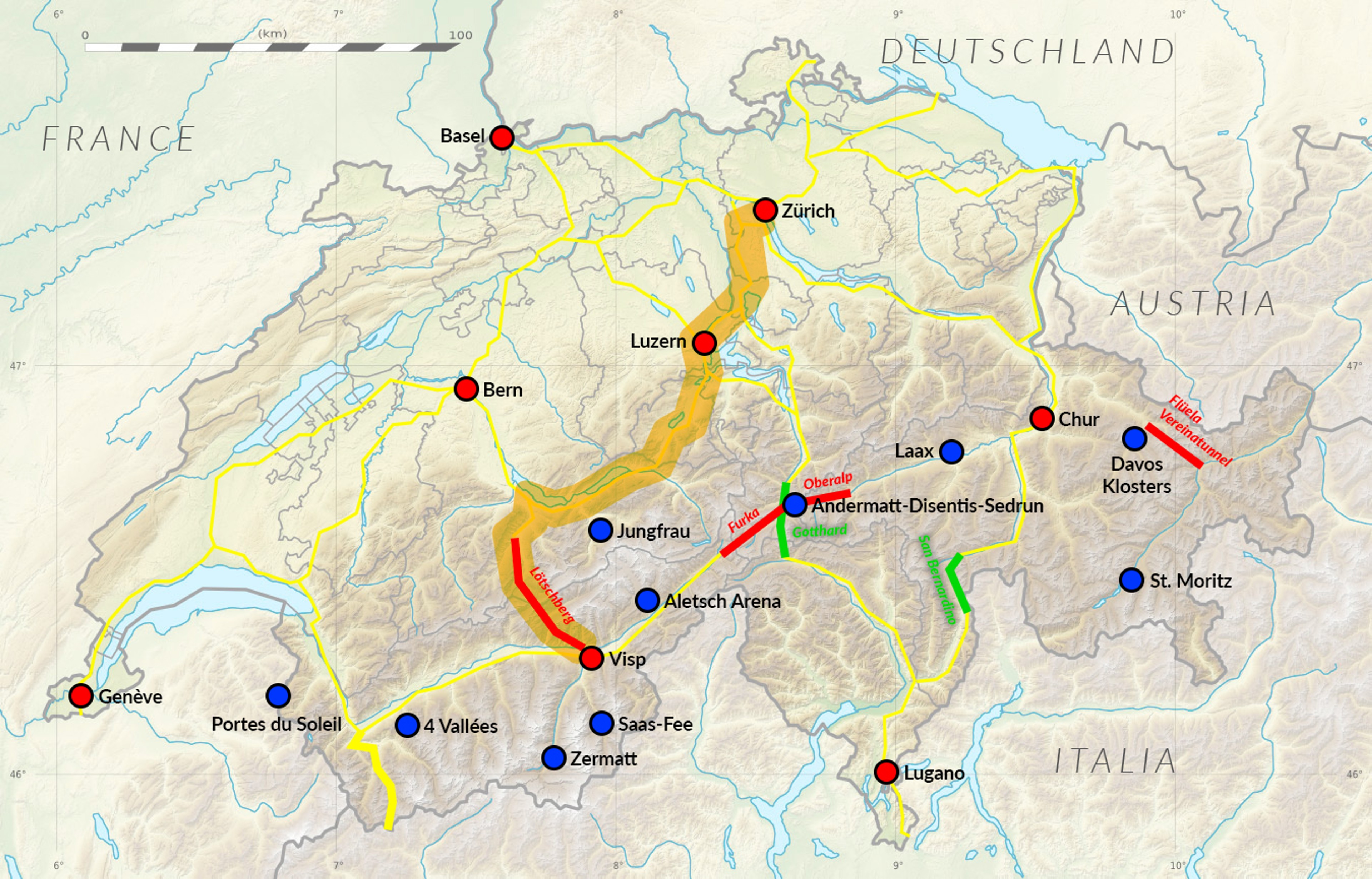
How to cross the mountain passes in Switzerland?
Switzerland's transportation network is very good, but heavily dependent on the terrain. To pass through the highest parts of the Alps, we sometimes have to overcome high mountain passes or long tunnels. During the winter season, most of the passes are not cleared of snow and we have to look for alternative routes.
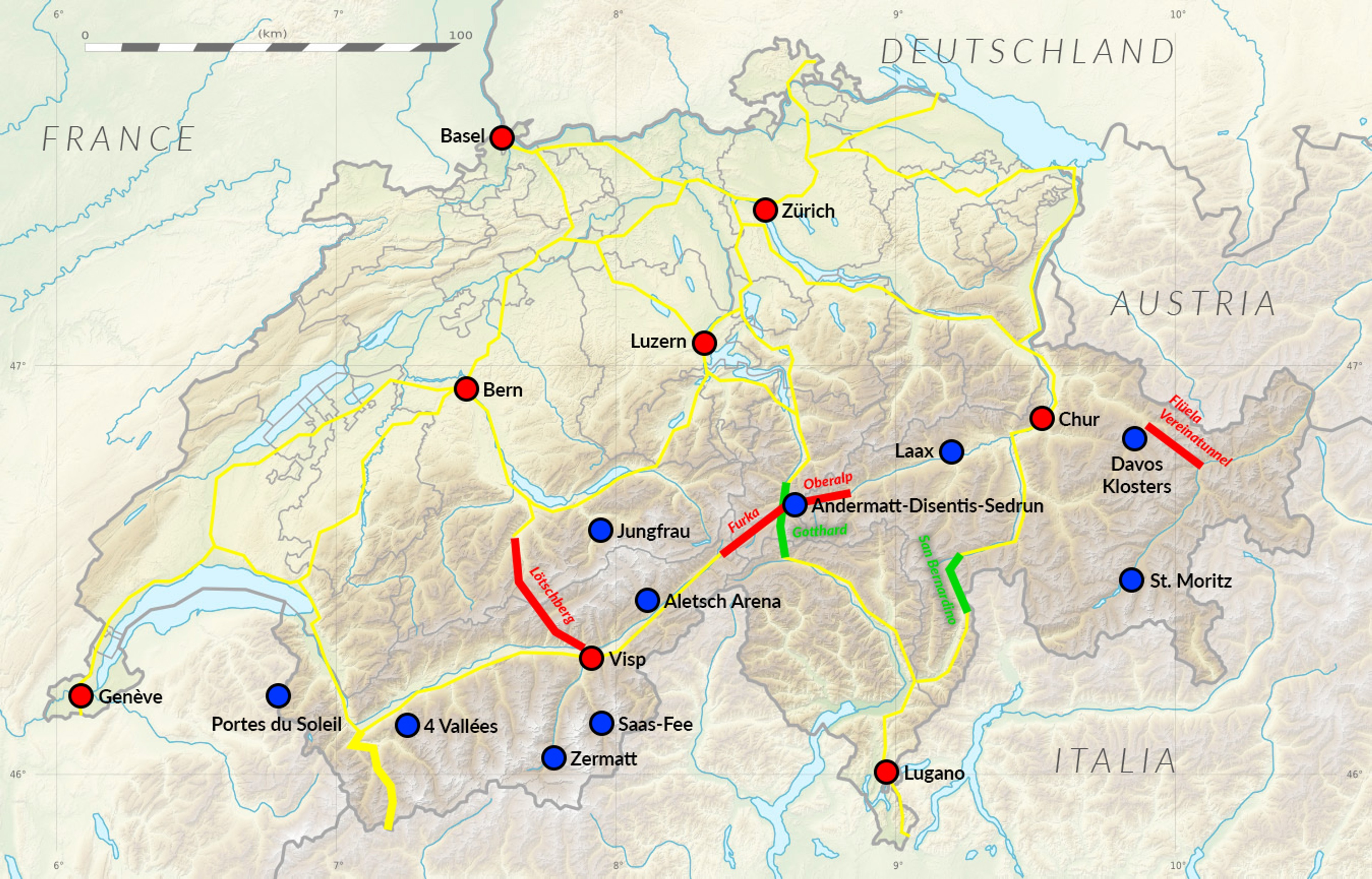
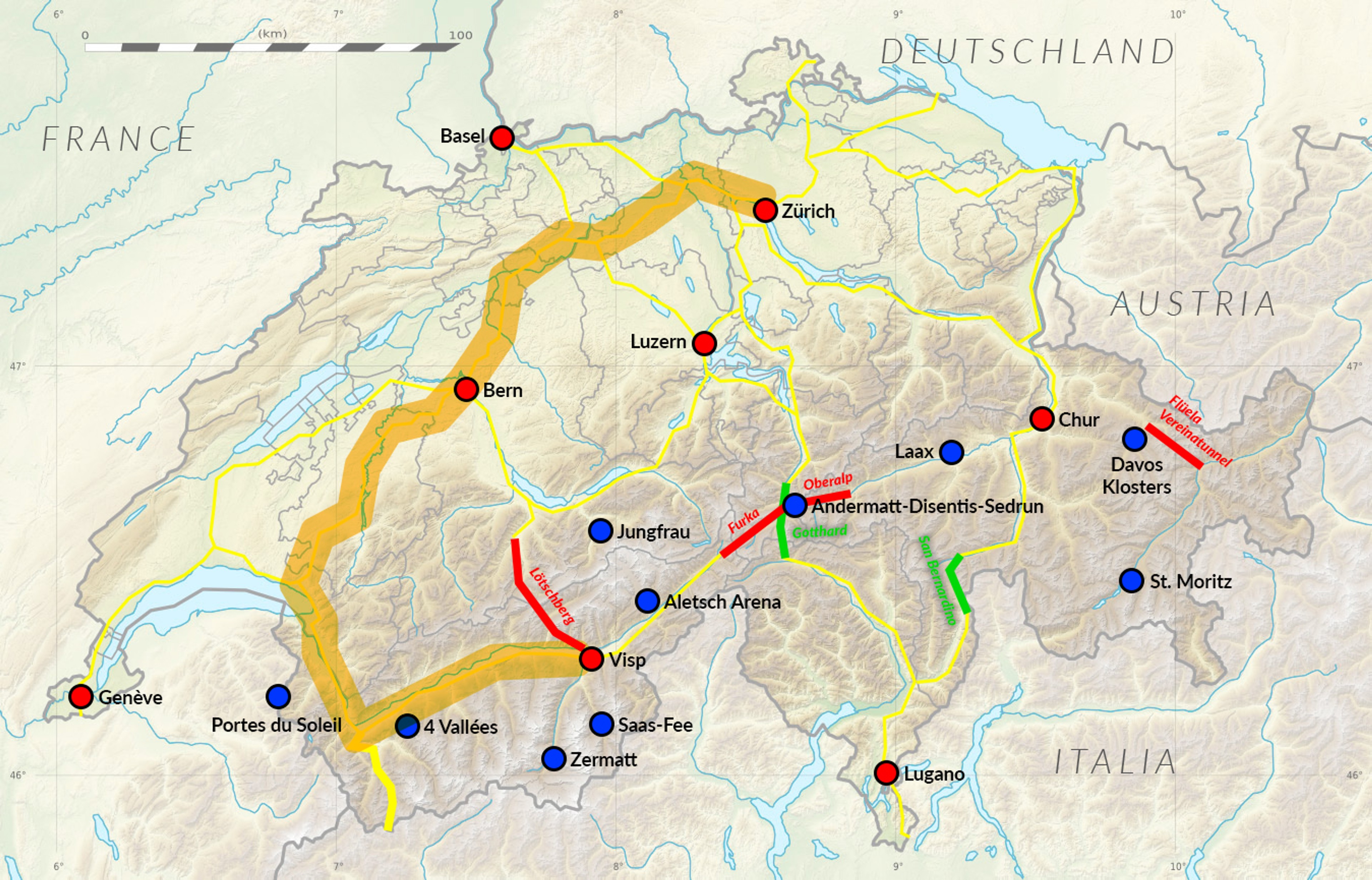
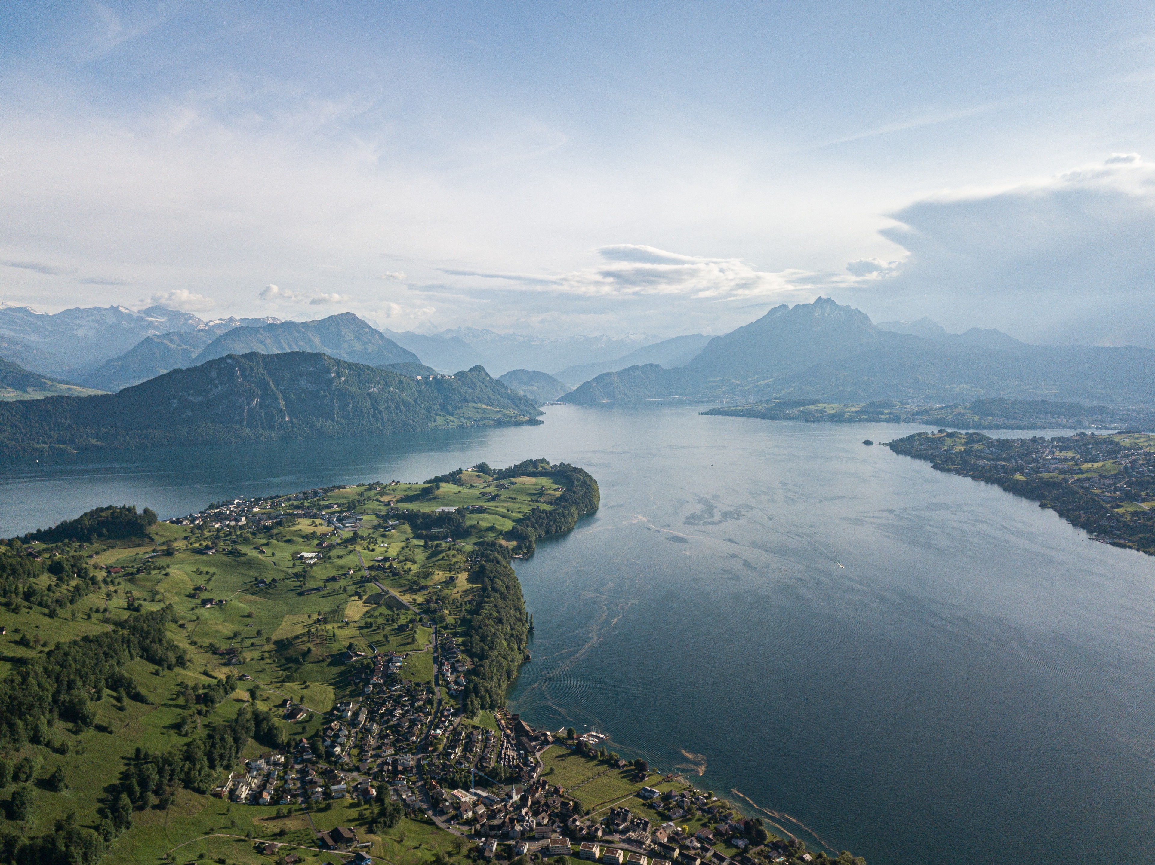
Traversing the country on a north-south axis, two passes are available: the Gotthard (2106 meters above sea level) and the San Bernardino (2066 meters above sea level). Both are "equipped" with long tunnels for comfortable winter travel. However, if you want to traverse the country on an east-west axis, the situation becomes more complicated.
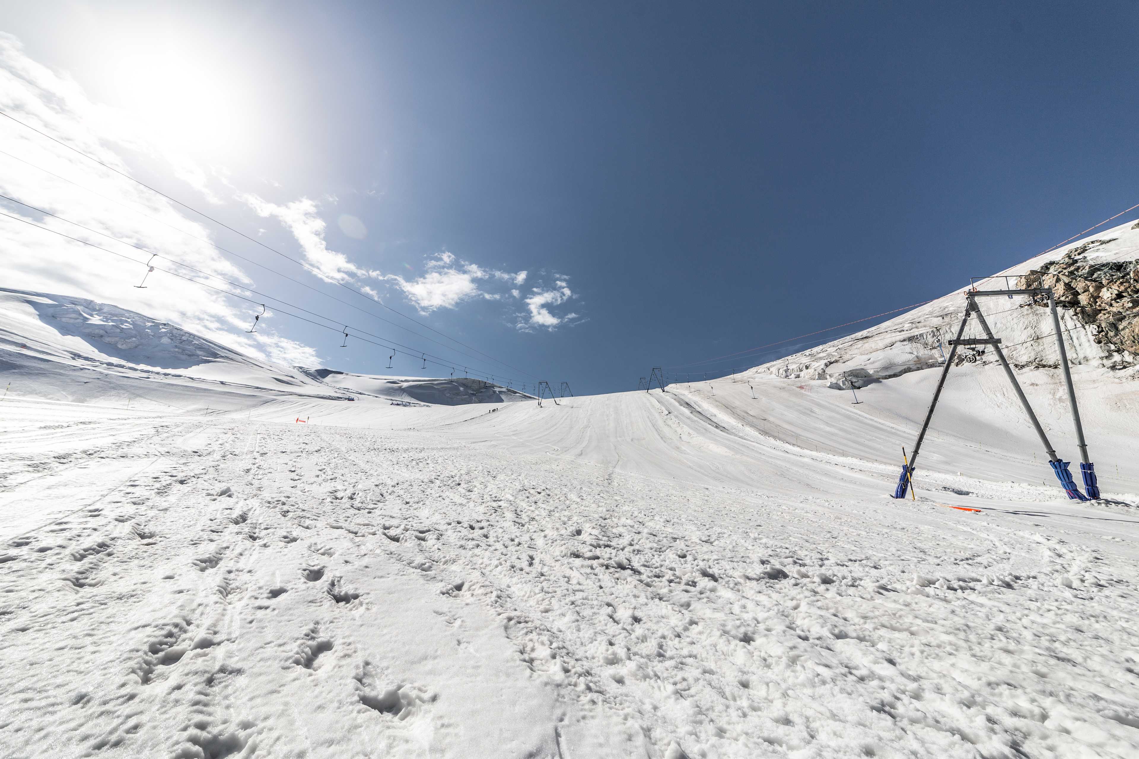
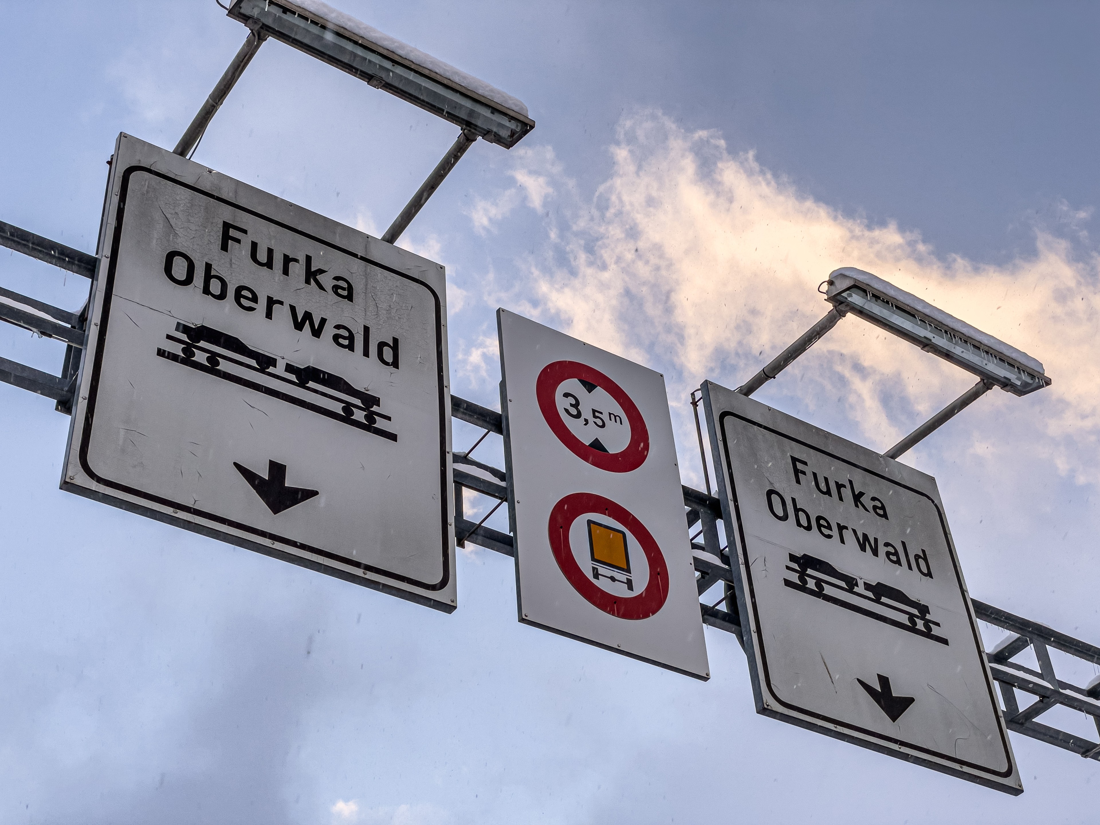
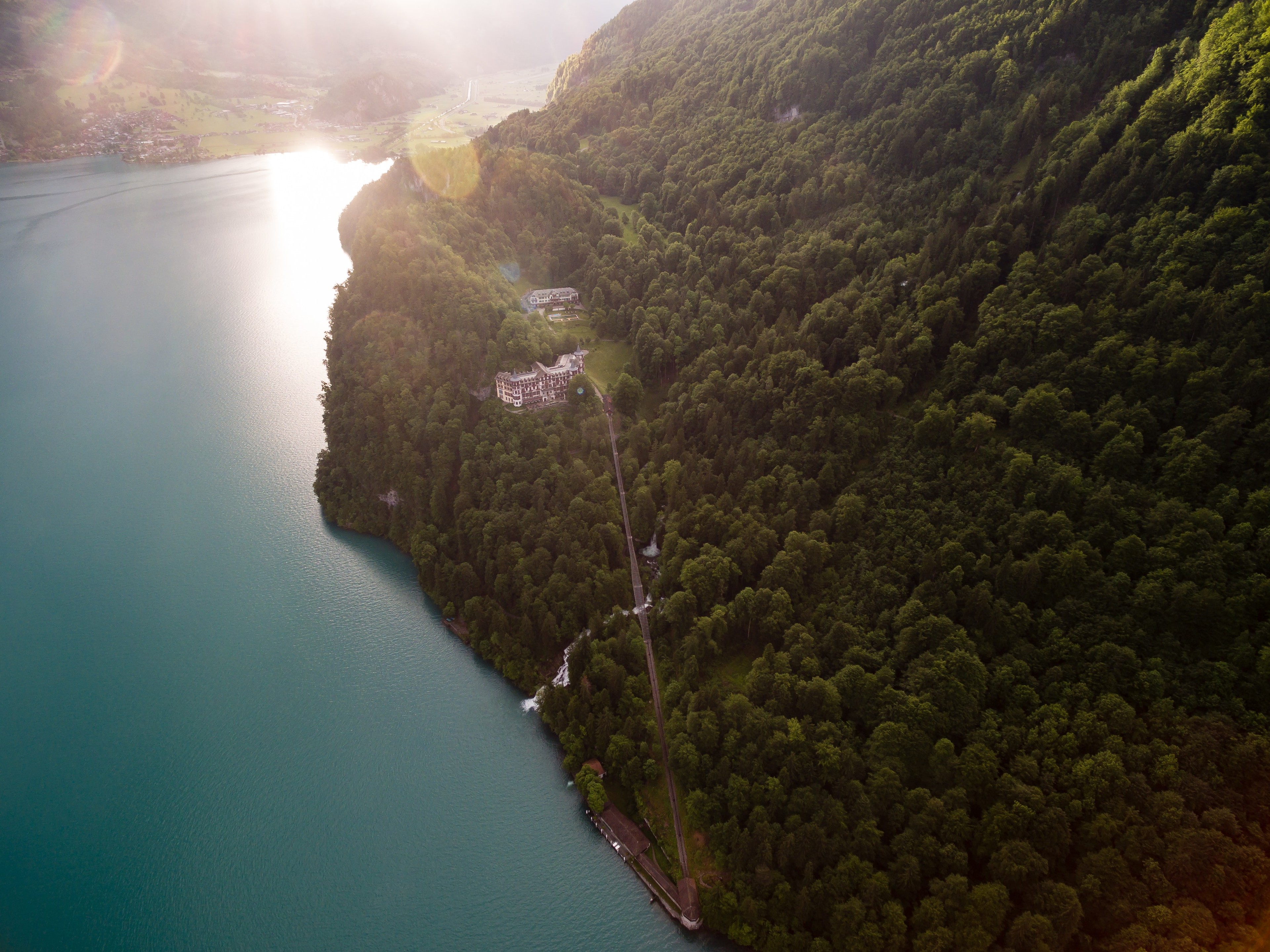
The Flüela, Oberalp, Furka, Susten and Grimsel passes are permanently closed, and all transportation relies on the Matterhorn Gotthard Railway shuttle trains under the Oberalp and Furka. In addition, another shuttle train running through the Lötschberg tunnel under the Jungfrau massif from Kandersteg (next to Interlaken and Thun) to Visp (Valais) is also available for drivers.
Why am I writing about this? Because by taking the trains through the Lötschberg and Furka tunnels we will reach the Rhône Valley in the canton of Valais. From here one will reach some very important ski resorts: Aletsch Arena, Saas-Fee, or finally Zermatt and Verbier. Wanting to get from Geneva to Andermatt we will face exactly the same problem, except that the Furka Pass will have to be crossed from west to east. Since most of the traffic is more or less on the Zurich-Visp line, this is the route I examine in this article.
How to get to Valais?
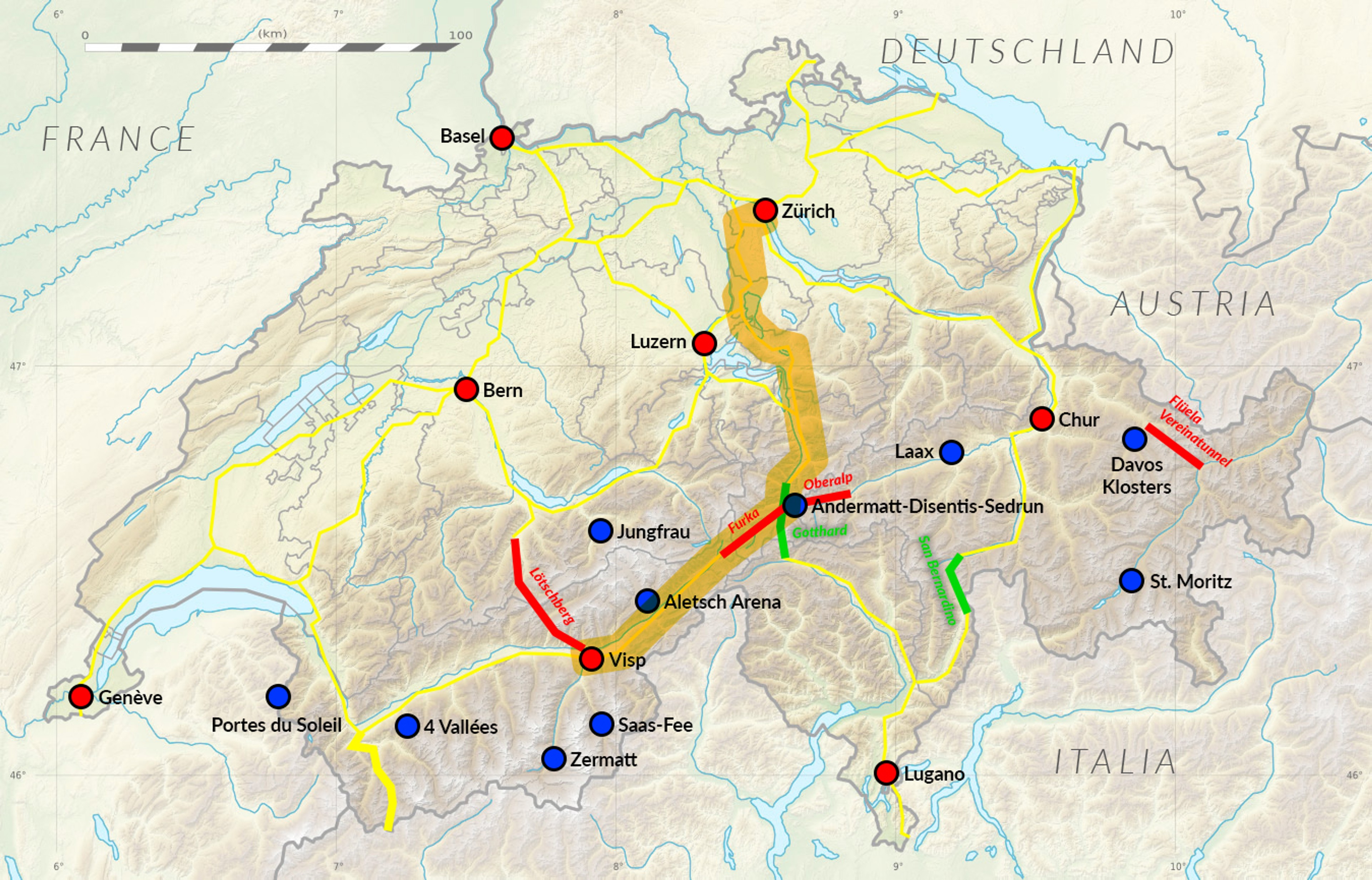
Tourists driving from the German-speaking part of Switzerland (Zurich, Basel) will face a dilemma. The Bernese Alps can be taken around the highways via Bern, Vevey and Montreux (option 1). This means that on the Zurich-Visp section you will make up almost 150 km. The alternative is just trains on the Realp-Oberwald line (Furka - Matterhorn Gotthard Railway, option 2) and Kandersteg-Goppenstein (Lötschberg, option 3). We can see all 3 options here:
You can always check the timetables and current waiting times at MGB Realp and Oberwald stations on MGB website. For the Lötschberg Tunnel you will see them on BLS website.
The cost of a one-way ticket in 2022 was CHF 25-35 for a passenger car, for both crossings. Train tickets can also be purchased online, so we don't have to leave the car in a freezing snowstorm, for example. The gates at the station will read our license plate number and automatically raise the barrier.
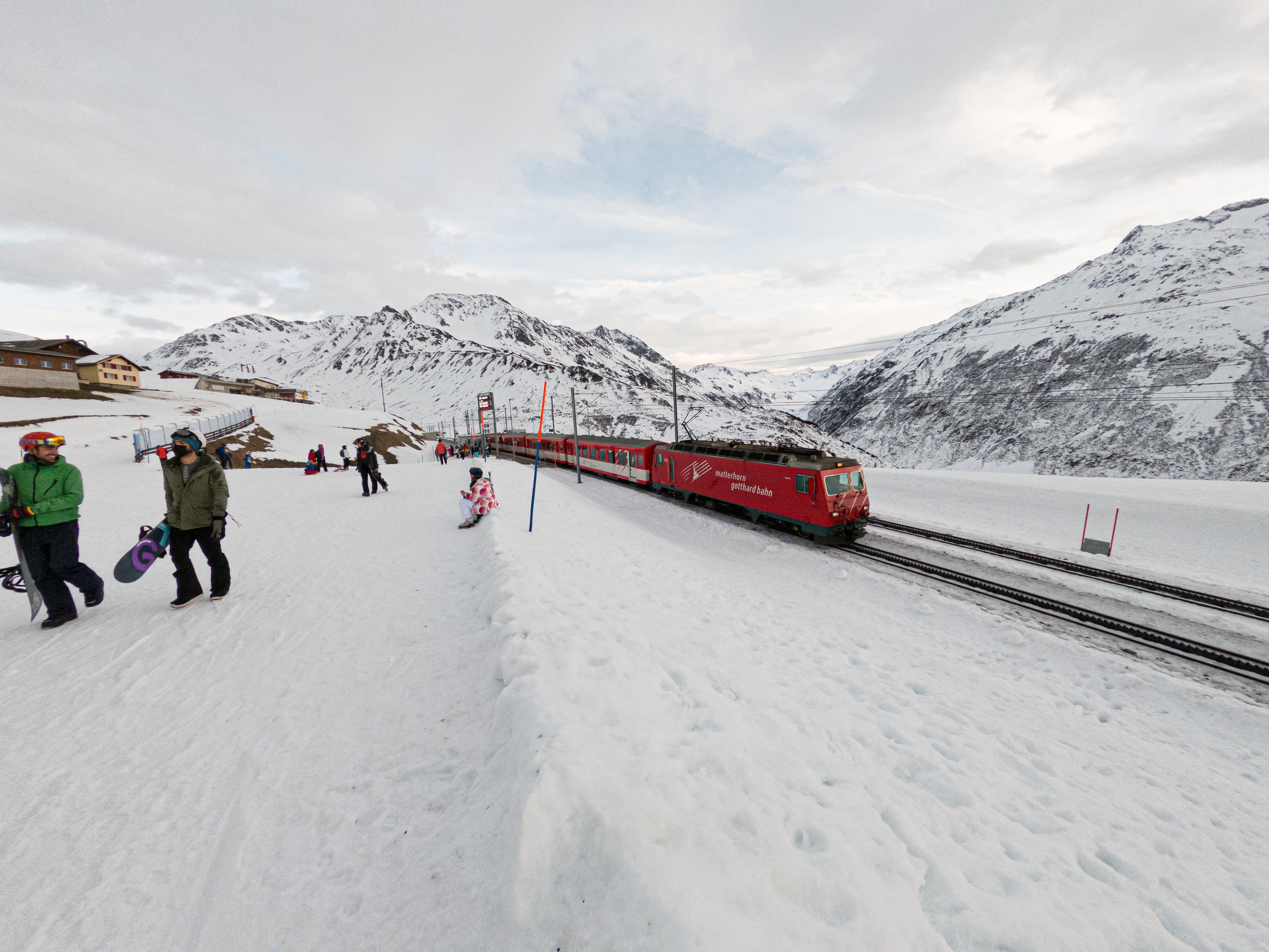
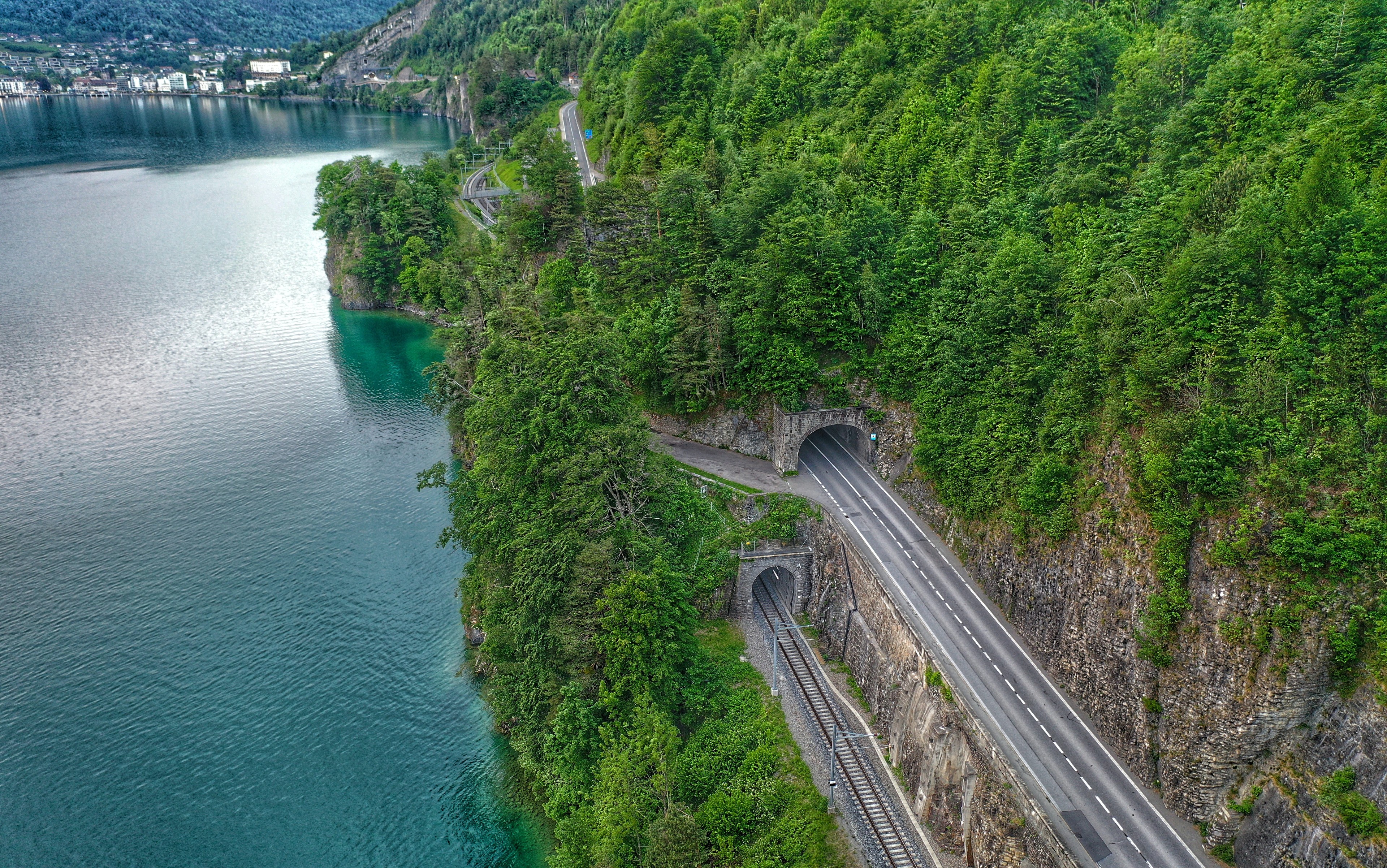
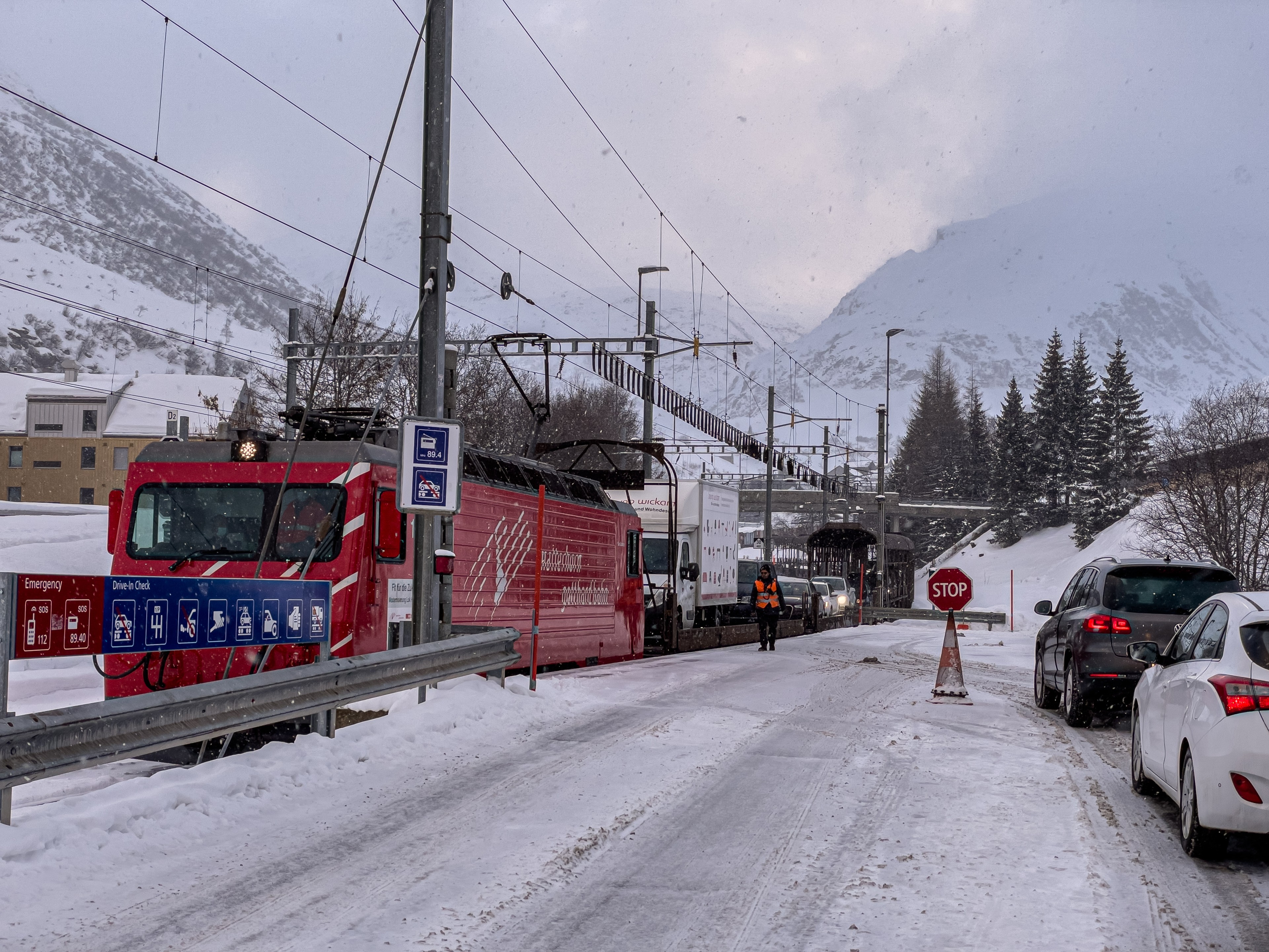
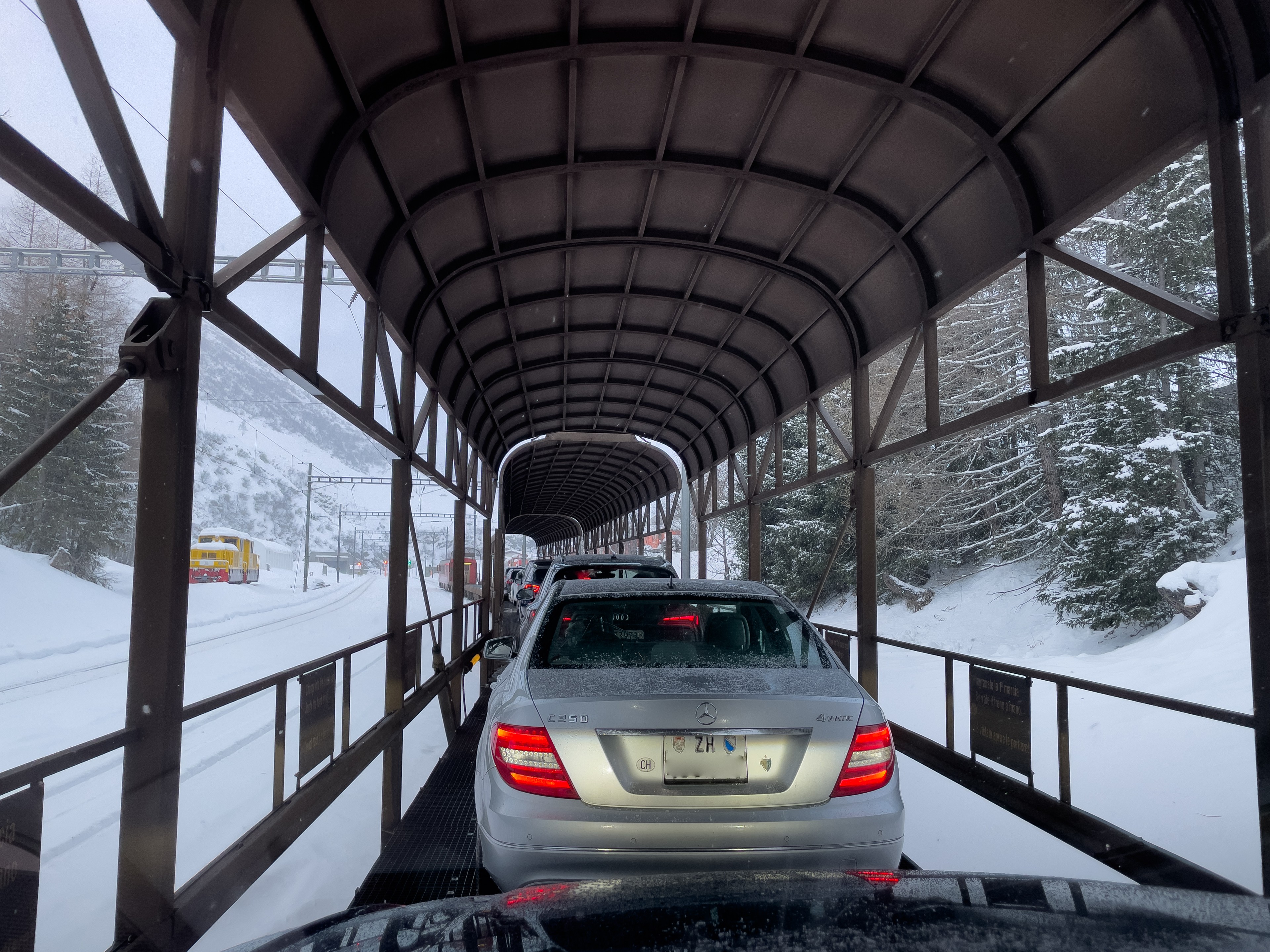
How to enter the train by car? Entering a train is not the easiest thing to do, especially with a large car. The staff directing traffic is there to help if necessary. Discipline is required of drivers, however, to maintain smooth transportation and minimize waiting times. Entrance to the platform is made at one point at the end of the train. The cars then pass between the cars lining up one behind the other from the beginning of the train. The carriages are open, and no one is allowed to get out of the car during the ride. How long does one stay in the car during transport by train? For both transports, the ride is mostly through a long (about 15 km) tunnel and takes no more than 20 minutes.
Option 1: Zurich-Bern-Montreux-Visp (highways A1, A12, A9).
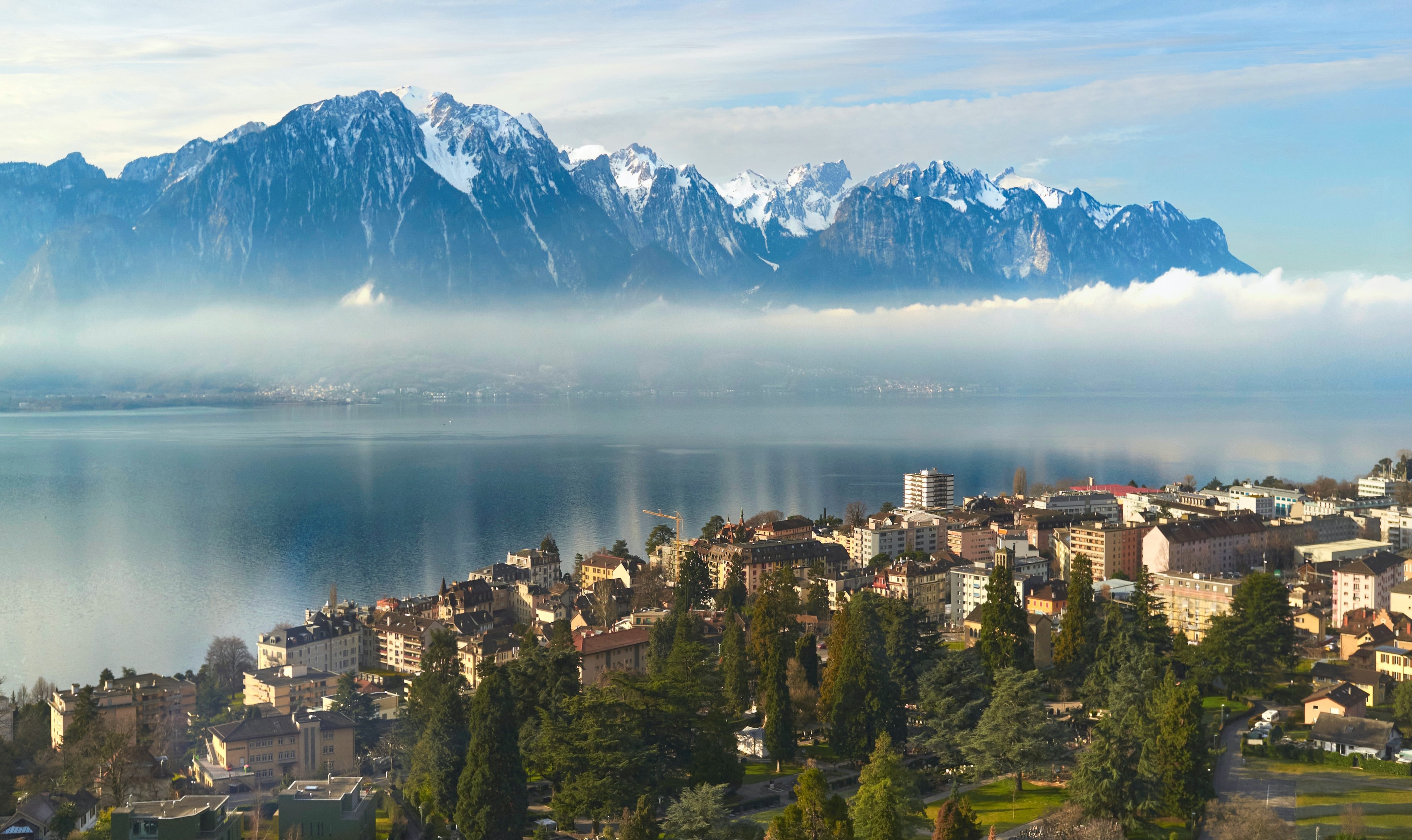
The entire route is based solely on highways and expressways. This is quite a popular and frequented transportation route in Switzerland. The A1 highway between Zurich and Bern is quite a busy road. Same for the stretch to Lake Geneva (A12). The road is easy, safe, mostly with two lanes in each direction. Traffic is heavy around Vevey and Montreux and we can expect traffic jams there. On the road we will also often have to slow down to 80 km/h, despite the highway.
In Vevey we have to take the A9 highway towards Martigny and Sion. The last stretch from Sierre to Visp we will have to drive on the two-way national road No. 9, which is successively being turned into the A9 highway (as of 2022).
- Distance: 318 km
- Typical driving time: 4 hours
- Additional costs: none
- Difficulty: easy
Option 2: Zurich-Andermatt-Visp (Furka - Matterhorn Gotthard Bahn).
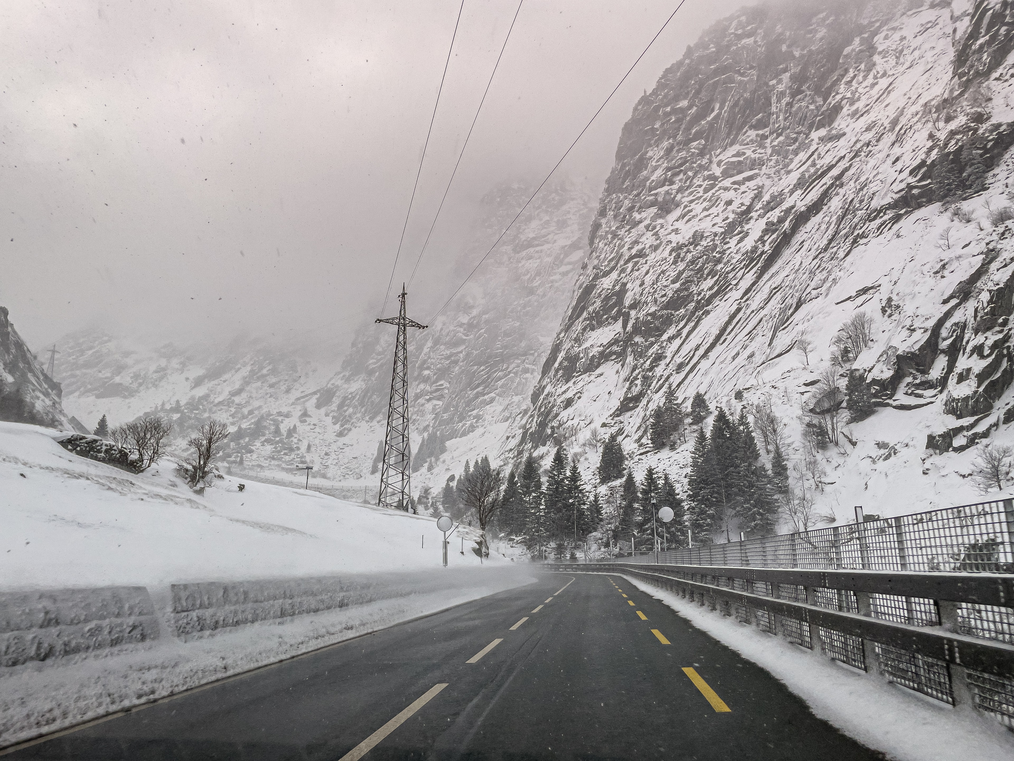
From Zurich, we head to the Gotthard Pass. This is an important direction, so on most road signs this name will appear. Usually the signs will lead you through Zug, Schwyz, Altdorf on the two-way A4 expressway called Axenstrasse. Sometimes, however, dynamic signposts recommend a route via the A14 and A2 highways through Lucerne. It's worth keeping an eye on this, as the Axenstrasse along Lake Lucerne is a road where accidents happen, and its rocky location means that there is sometimes work to repair and clear the road of landslide stones. The road through the city of Lucerne, on the other hand, is slightly longer, with at least two lanes in each direction along its entire length. Traffic is so heavy in Lucerne that you almost always have to queue in a traffic jam. For this reason, if possible, I still recommend driving via Axenstrasse (Schwyz-Altdorf). From Altdorf the two roads join and follow the Reuss River valley toward the Gotthard road tunnel and the Andermatt above it.
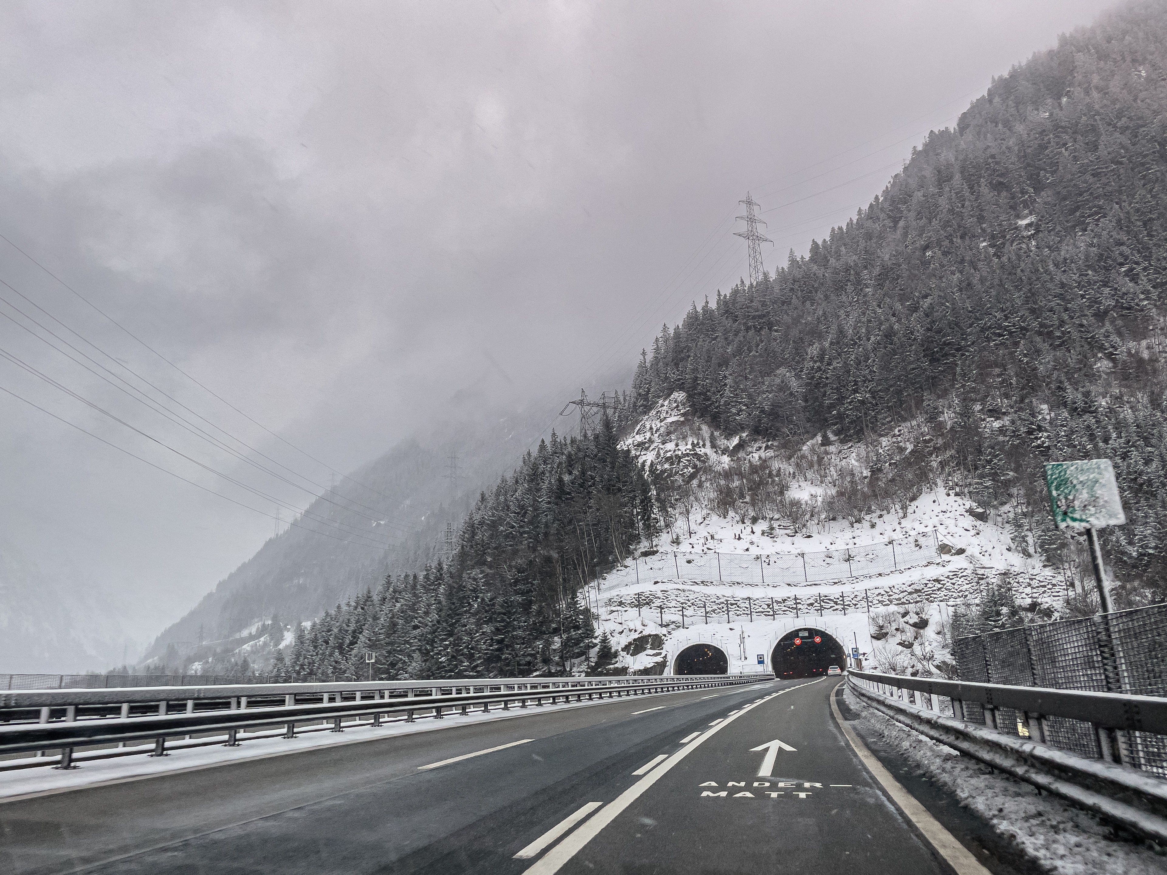
To reach the Furka Pass and the Realp station, we take the A2 highway off in the direction of Andermatt. We will not be entering the Gotthard Tunnel, but the traffic jam in front of it can be so long that we should leave the highway earlier than before the tunnel itself. For this reason, I recommend using traffic-aware navigation.
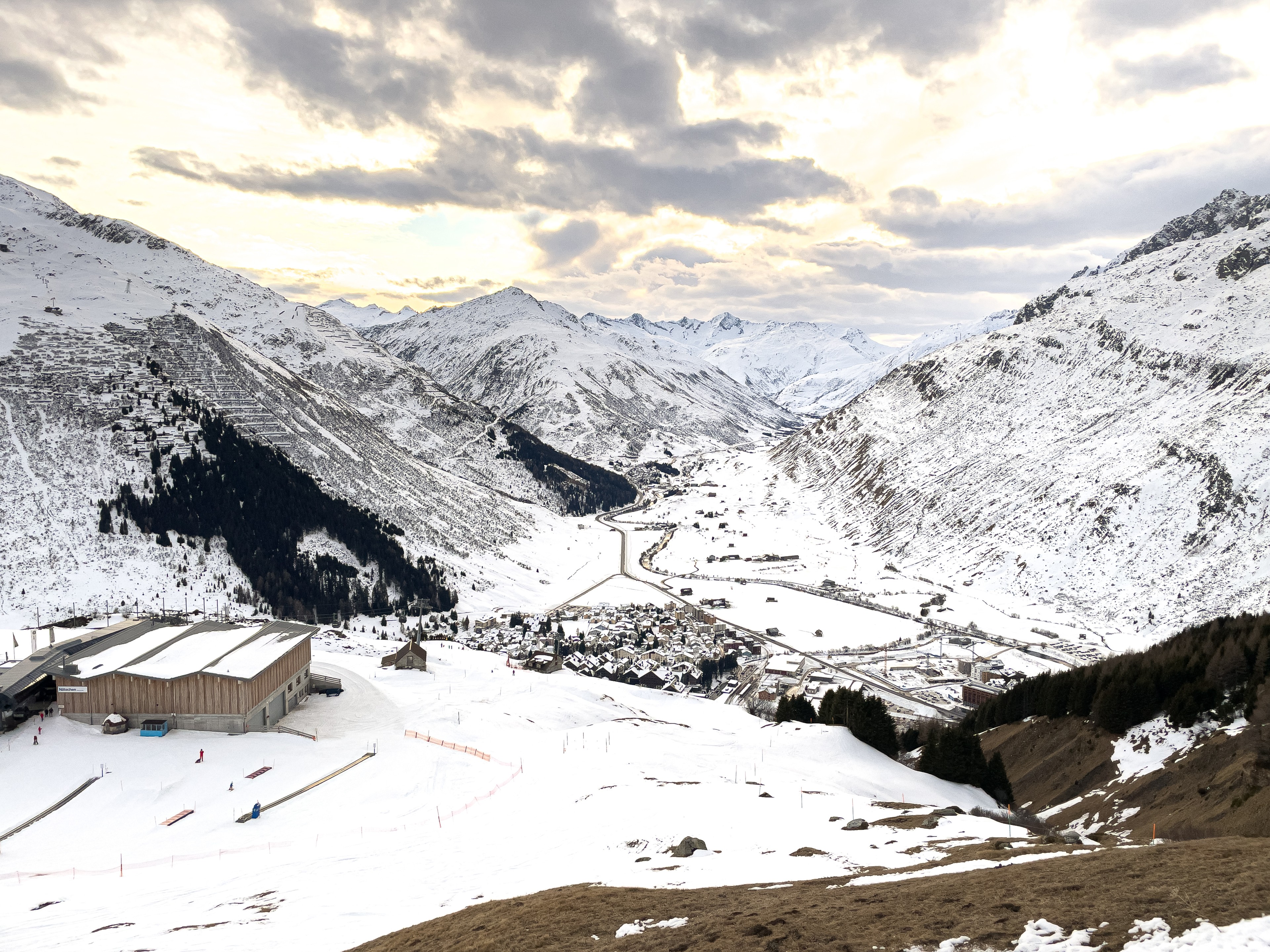
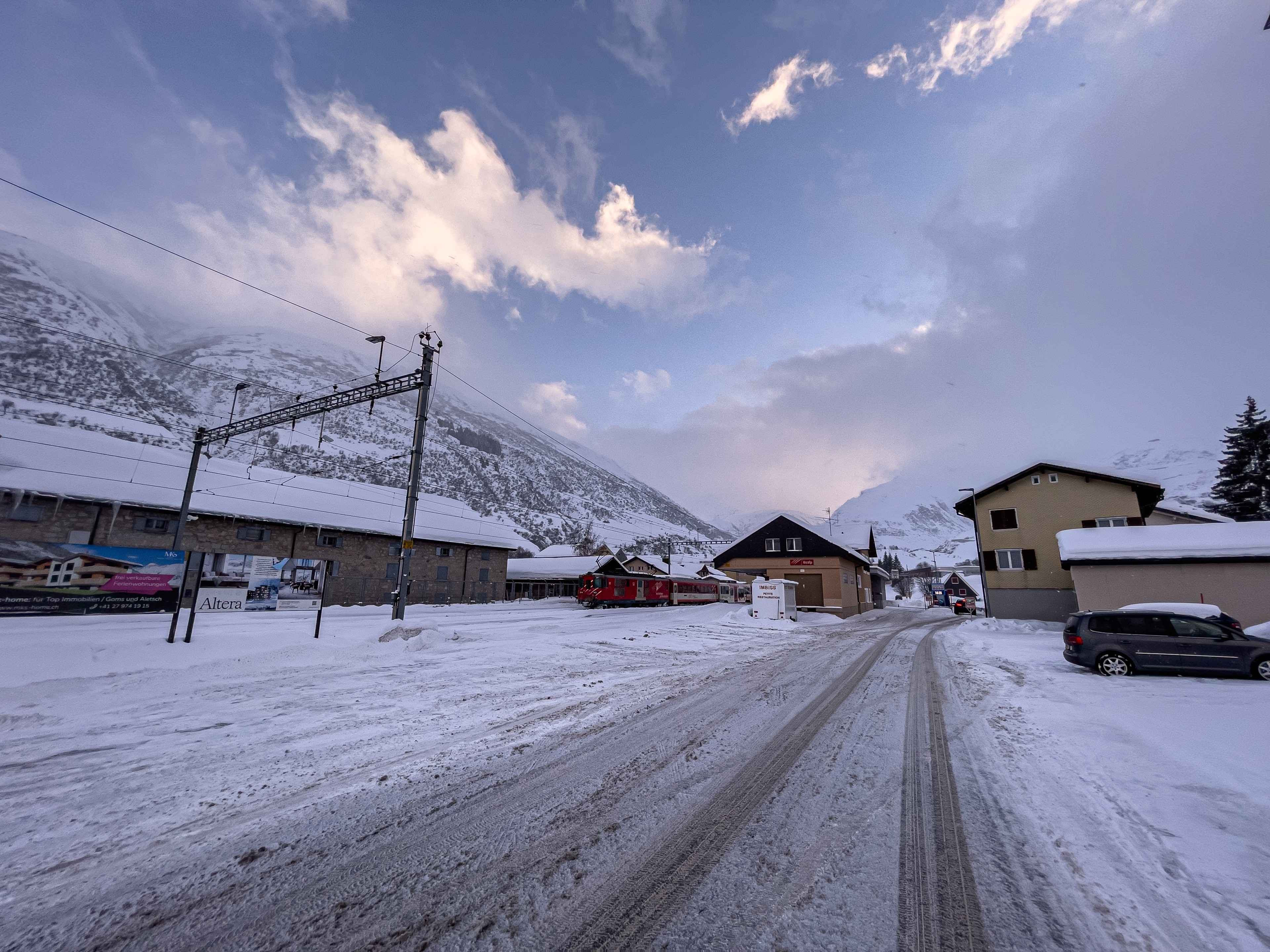
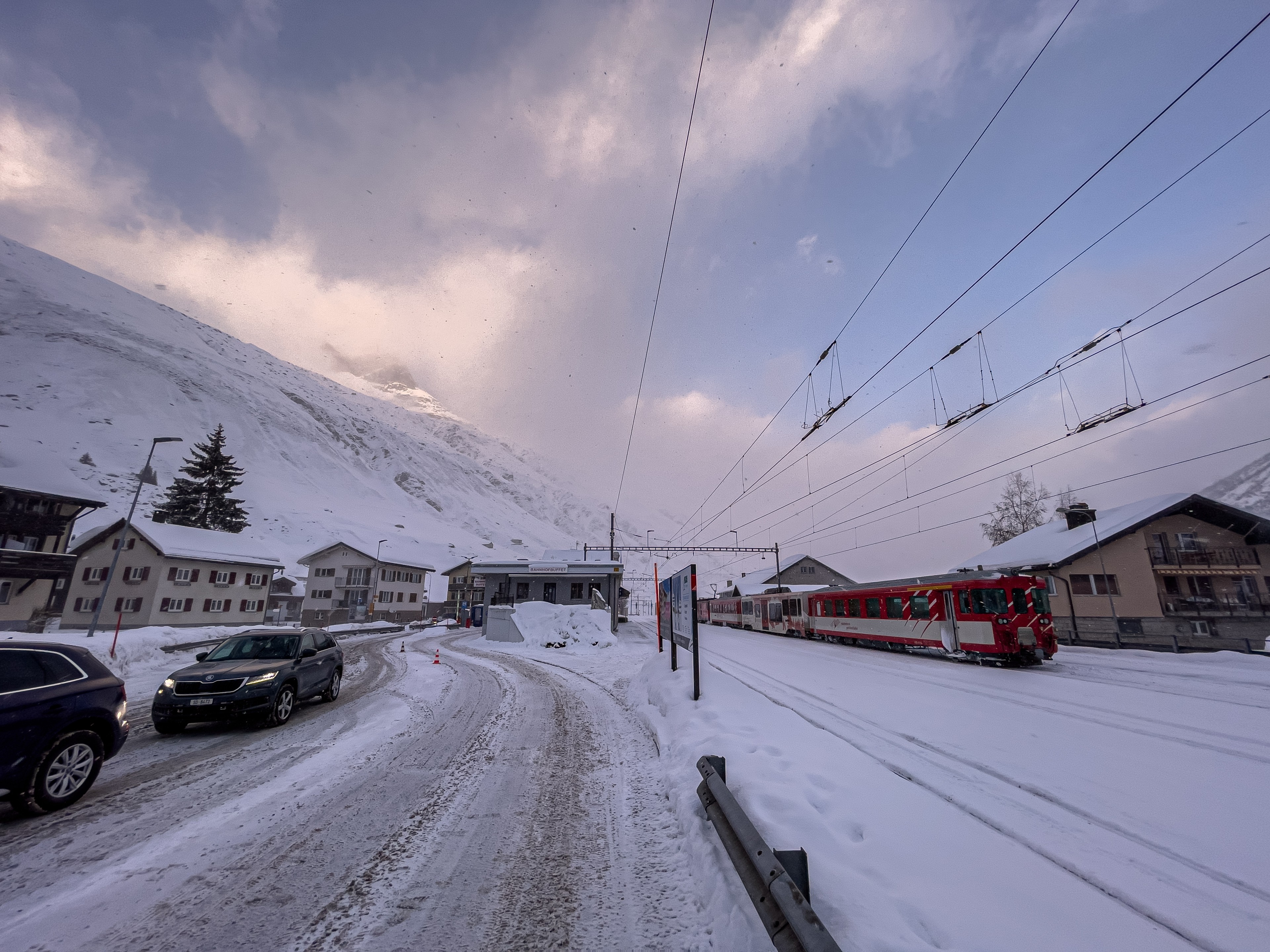
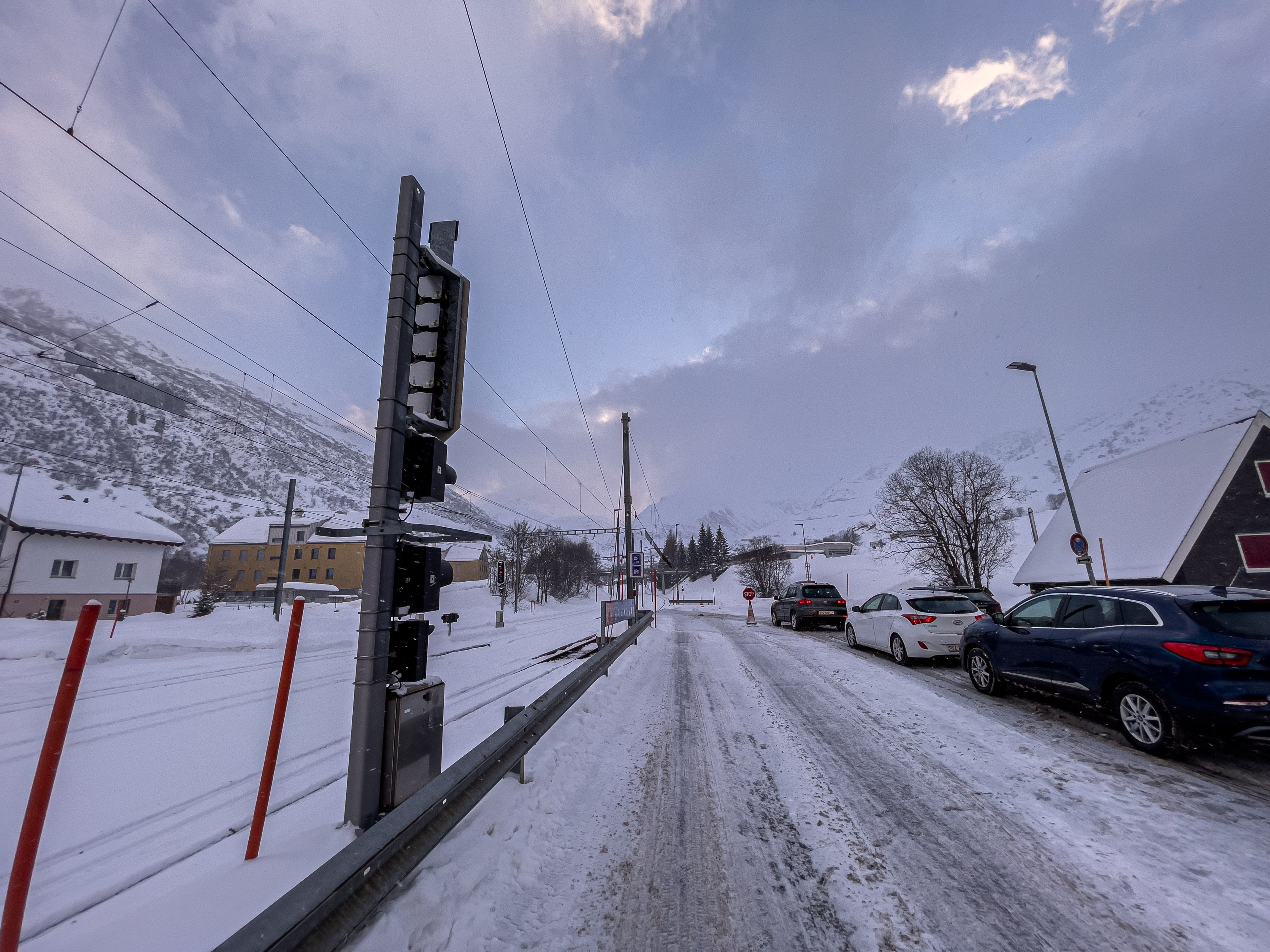
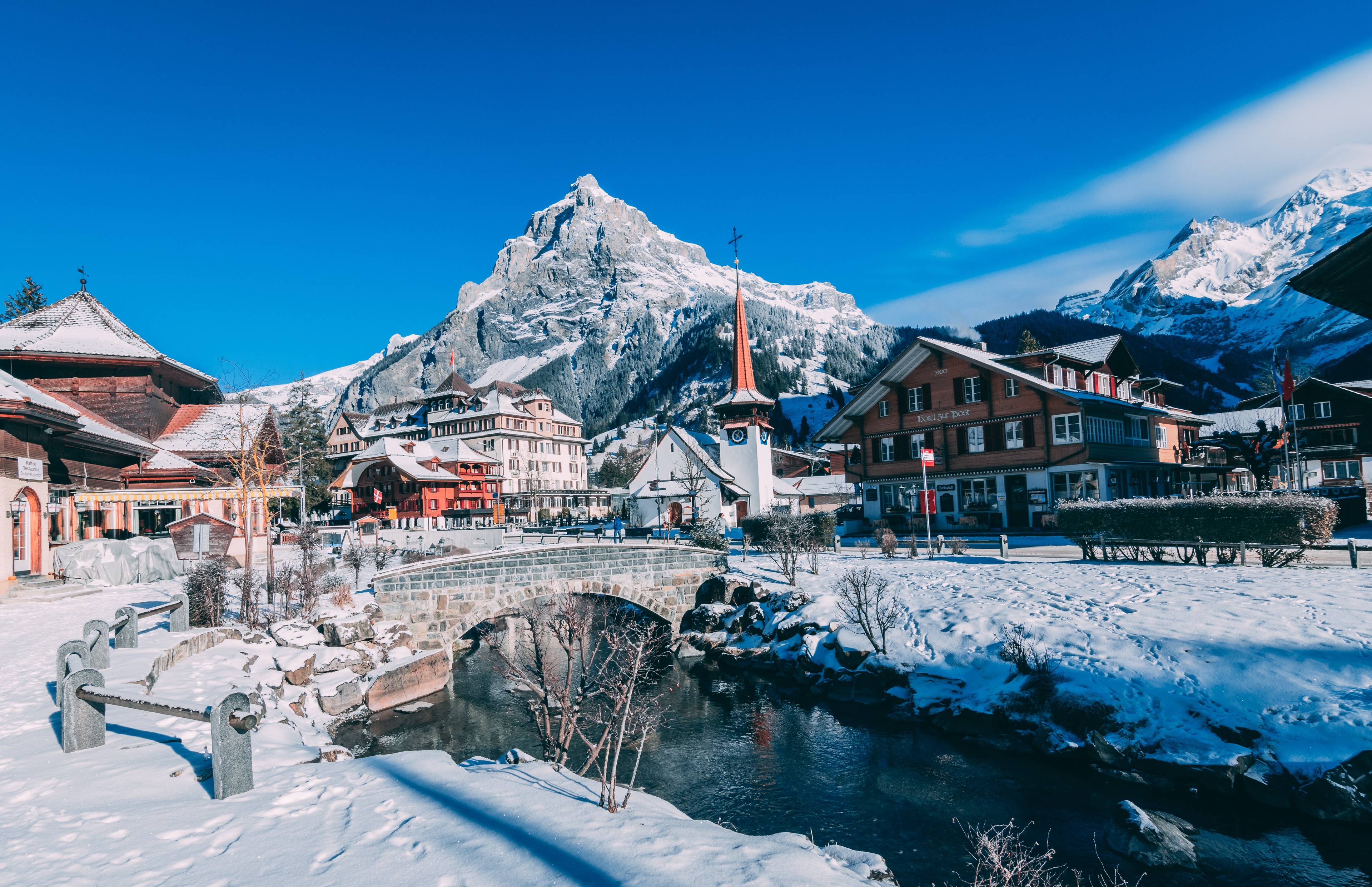
The last section is a fairly steep but safe climb to Andermatt (where ski resort is also located). From there we have to follow the signs to Realp and Furka Pass. The entire road is well marked. We will also see signs indicating whether the passes are open to car traffic. This information has nothing to do with train traffic, so it is normal that in winter the Furkapass sign will be 'geschlossen' (German for closed). It is worth mentioning that in rare extreme weather on the road to Andermatt we may need to put chains on the wheels. A 4x4 drive will certainly help here as well.
If we're lucky, we'll only see a few cars in the queue at Realp. There is a restaurant and restroom at the station. However, waiting times can be long, especially in high season and on weekends. The trains of the Matterhorn Gotthard Railway (MGB) run in shuttle service, and have a passing station in the Furka Tunnel, allowing them to run at a frequency of every 30 minutes.
The rest of the way we will have to travel no longer on the highway, but on the two-way national road No. 19.
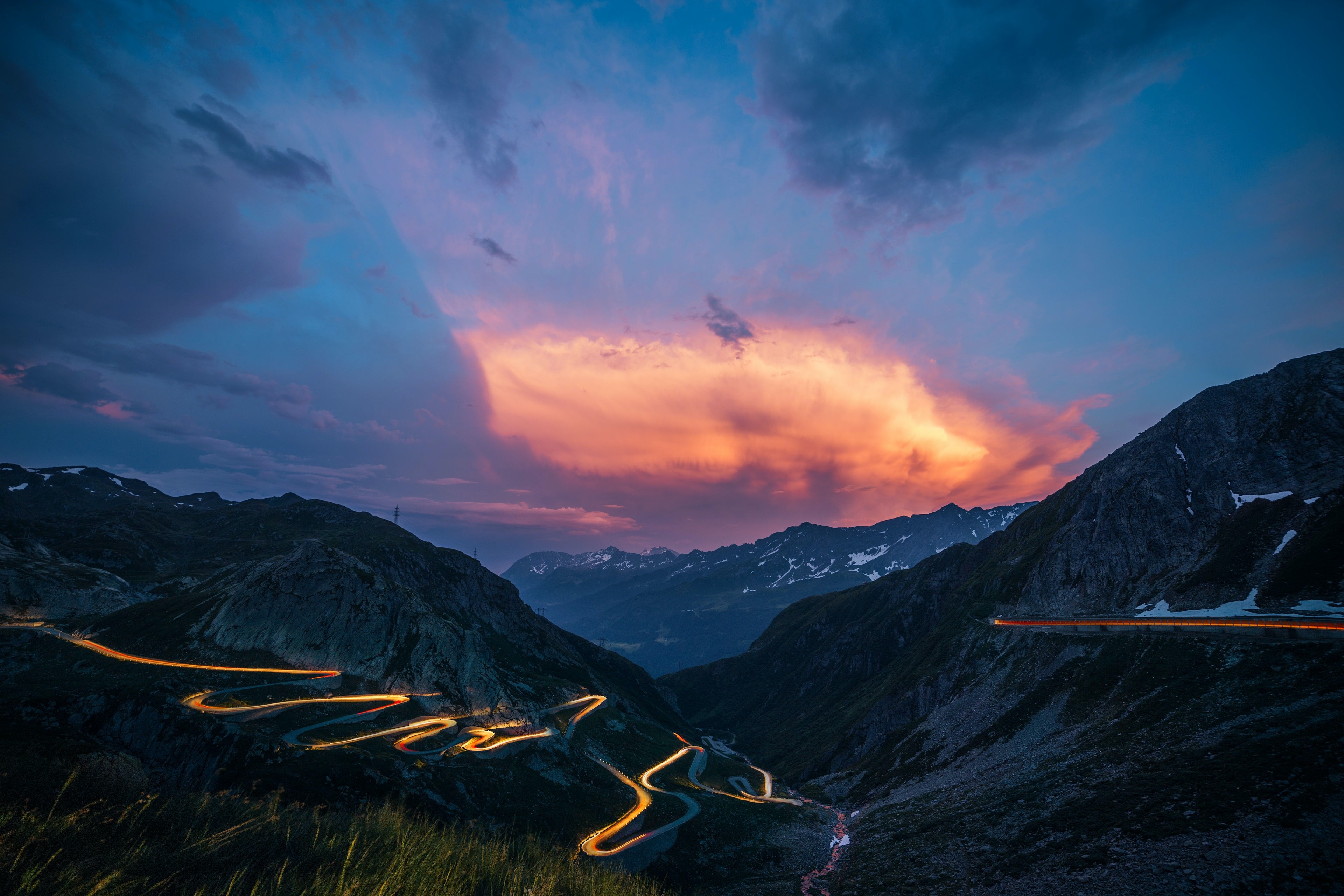
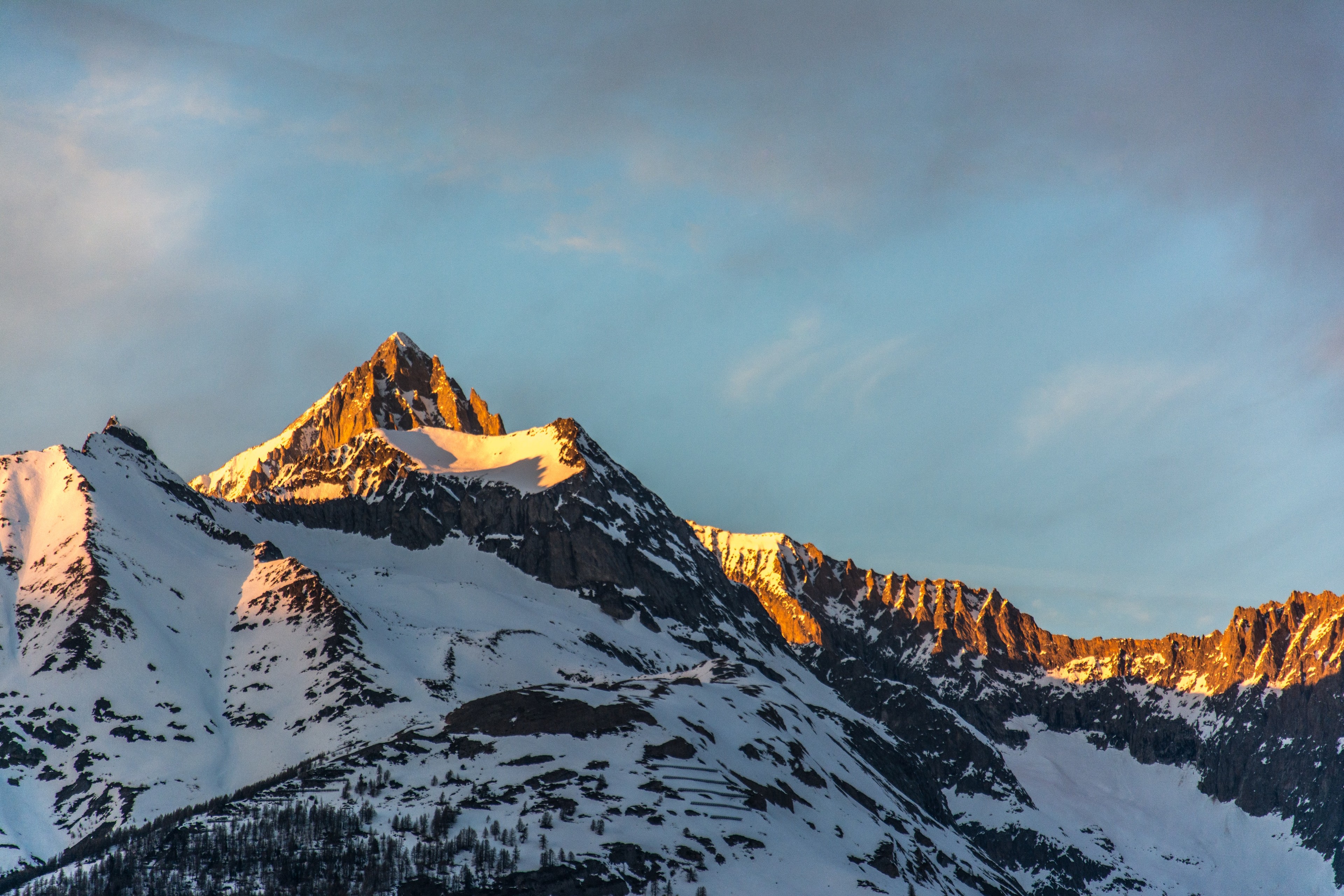
The slower pace will be rewarded by the beautiful villages and the ever-visible massifs of the Bernese and Lepontine Alps, between which we will have the pleasure of driving.
From the town of Brig, the road turns into a highway, which as of 2022 ends exactly in Visp.
- Distance: 184 km
- Typical driving time: 3 hours + train waiting time
- Additional costs: train ticket, about 33 CHF
- Difficulty: medium/difficult

Option 3: Zurich-Lucerne-Visp and Zurich-Bern-Thun-Visp (Lötschberg).
This option assumes driving through Lucerne on the A14 and A2 highways. If you're coming from Basel, you can get here via the A2, but it seems more sensible to go via Bern and Thun. For the sake of this article, however, I am describing the route from Zurich.
Several highways meet in Lucerne, and traffic is so heavy in the numerous tunnels that we almost always get stuck in traffic here. Heading south, we head for Interlaken and exit the A2 just before Stans. The route continues along the A8 expressway, which, despite its two-way nature, nimbly avoids most of the towns through tunnels. The only more difficult bit is the winding Lungern-Brienz section, where we will have to cross the Brünig Pass (1008 meters above sea level). This road is open in winter and is regularly cleared of snow. Then, along the beautiful Brienz lake, we drive all the way to Interlaken and continue the journey all the way to Spiez.
A quite reasonable alternative to this road is the highway through Bern (overlapping with option 1), where we turn at Thun and drive all the way to Spiez. This way we will skip the traffic jam in Lucerne and the mountainous section to Lake Brienz, but we will make up 20 km compared to the road through Lucerne.
Regardless of the chosen option, in Spiez we turn to Kandersteg. There we will find the station of the BLS railroad transporting cars to the canton of Wallis/Valais. As in the case of going through the Furka tunnel, we may encounter a queue of cars waiting for the train. Sometimes the waiting times can reach as long as 1-2h. Trains in the Lötschberg Tunnel run according to a schedule that takes into account the trend of traffic at a given time of day. It can therefore happen that trains run every 20-30 minutes in one direction and every hour in the other. Before departing, it's a good idea to check the schedule on the operator's website (BLS). Tickets bought online do not have a specific date, and can be used within a certain period of time.
The terminus station for train transportation is 15 kilometers away, in the town of Goppenstein. From there you will take a winding road down to the Rhone valley, where one must head to Visp.
- Distance: 200-220 km
- Typical driving time: 3 hours + waiting time for the train
- Additional costs: train ticket, about 30 CHF
- Difficulty: medium
Verdict
When we traveled from Zurich to Zermatt in the winter of 2022, we used option #2. It was the high season (February). We traveled in the first direction on an unusual date - Thursday. We boarded the train almost immediately and drove the entire route to Visp even a bit faster than the Google Maps app had mapped out for us. The decision for the return journey seemed obvious. Why make up 150 km of road and drive an hour longer?
We took the proven route, and Oberwald was in for an unpleasant surprise. Returning on Sunday evening proved to be a popular choice. We waited almost an hour and a half for the train.
So the travel time was similar to Option 1. We did fewer kilometers, but we had to buy a train ticket. A tie?
We already know that transportation by train is very convenient and significantly shortened our route. However, the route to Andermatt will not be to everyone's liking, and in worse conditions it may turn out that option 1, albeit a longer distance, will be faster. However, if you are interested in experience, beautiful views and passing through a very long tunnel on a train car, the route with the Matterhorn Gotthard railroad is quite an attraction.
The least interesting route here seems to be option 3, which by distance is no longer so attractive, and the waiting time for the train in the Lötschberg tunnel can be longer. However, it is worthy of consideration for drivers coming from Basel. As a one-size-fits-all solution, I would suggest making a decision each time taking into account road conditions. Are there traffic jams on the highways? Are we driving on a turnaround day? What is the waiting time for the train? Navigation will also tell us which variant will be the fastest. Safe travels!
Read also